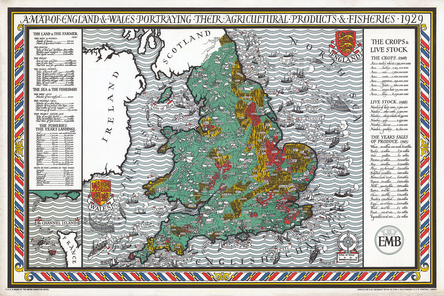


1929 Map of England and Wales Portraying Agricultural Products and Fisheries
1929 Map of England and Wales Portraying Agricultural Products and Fisheries
Regular price
£353.00 GBP
Regular price
Sale price
£353.00 GBP
Unit price
per
Tax included.
Shipping calculated at checkout.
Couldn't load pickup availability
England's economic data visualised in this pictorial map produced in 1929. A complete inventory of crops, livestock, land, fisheries, employment and GDP.
Printed on 310gsm matt textured Hahnemühle German Etching. Genuine art paper offering maximum age resistance.
Handmade to order.
All map prints are sent unframed, unless otherwise requested.
Shipping: Royal Mail or Deutsche post.
Find us on Redbubble for more products.