
In the midst of the tumultuous years of World War 2, a unique and beautifully illustrated map emerged, capturing the essence of Kent, known as the ‘Garden of England.’ This map, specifically created for the Women’s Land Army Benevolent Fund, serves not only as a geographical guide but also as a historical artifact celebrating the contributions of women during the Battle for Britain during 1940.
The map is a pictorial masterpiece, adorned with royal seals and embedded with snippets of historic text.
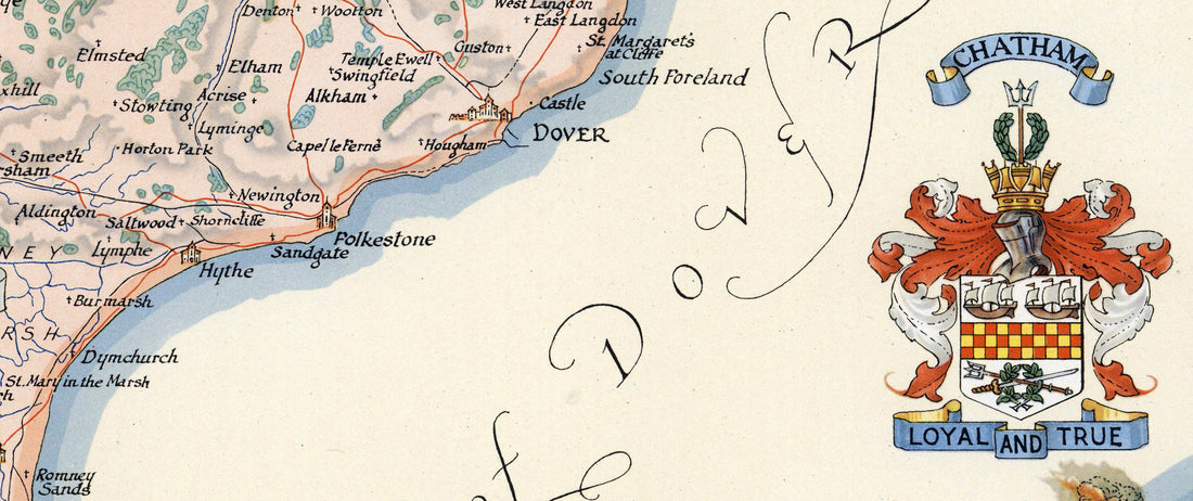
- Royal Seals: The map features the coats of arms of the Royal Family, lending an air of nobility and patriotism. These seals are not just decorative; they symbolise the monarchy’s endorsement and appreciation of the wartime efforts on the home front.
- Pictorial Illustrations: Beyond mere geographical representation, the map showcases landmarks, both natural and man-made. From the white cliffs of Dover to the historic castles and cathedrals, each element is drawn with an artistic flair that evokes the spirit of Kent.
- Historical Text: Interspersed among the illustrations are brief historical notes, providing context to the landmarks and events associated with Kent during the war. This text serves educational purposes, linking the land’s heritage with its wartime narrative.
Kent was at the eye of the storm during the Battle of Britain. Its strategic location made it a primary target for Luftwaffe bombings, but it also stood as a frontline defence for Britain. The map reflects this period.
- Airfields and Military Sites: The map marks key airfields like Biggin Hill and Manston, which were central to the RAF’s defence efforts. These sites were not only military but also became symbols of resilience.
- Role of the Women’s Land Army: The Women’s Land Army, for whom the map was produced, played a crucial role in agriculture. With many men away at war, these women took on vital farming roles to keep the country fed. The map serves as a fundraiser for their benevolent fund, highlighting their indispensable work.
- Symbolism of Resilience: The map uses imagery of blooming plants and harvests to symbolise growth and continuity in times of destruction. This contrasts sharply with the reality of the bombings but serves to inspire hope and perseverance.
- Educational Tool: For those unfamiliar with the geography or history of Kent, the map acts as an educational tool, blending art with information to create a narrative our the land during wartime.
Today, this map stands as a testament to the spirit of the time, encapsulating both the somber reality of war and the vibrant spirit of those who lived through it. The proceeds from the map sales went to support the women who worked tirelessly on the farms, ensuring their welfare post-war.
The Battle of Britain is more than just a cartographic depiction. It is a narrative woven into art, celebrating the land, its defenders, and the women who kept Britain’s heartland alive. This map serves as a piece of history, a poignant reminder of human endurance and the often unsung contributions of women in wartime. It remains a cherished piece of British heritage.
#battleofbritain #war #women
Connect with us on Redbubble.